The WhalesBack Canada
- Dec 13, 2017
- 3 min read
Located in Northern Ontario, there are two little towns along the Northern Channel of Lake Huron. Between them not only lies a stretch of paved highway, but also one of the most scenic and explorer friendly waterways in Ontario. Sailors from around the world travel thousands of Nautical miles just to experience the famous Whalesback. The Whalesback is a channel between John Island, and the mainland (Serpent River Indian reserve). This is an explorers paradise, manoeuvre between islands, anchor in calm and protected harbours, and have picnics on some of the most beautiful sandy beaches along the North Channel.
So, how do you get there, simple just launch your watercraft from any of the municipal boat launches located in and around either Blind River or Spanish. If you launch from Spanish, then you'll want to head West, and if you launch from Blind River you'll want to head East. During the summer months of July and August you won't miss it, just find a sailboat heading in your desired direction and they are most likely heading for the Whalesback. Also, please view our interactive map below for details on our trip in 2017.
Trip along the Whales Back, 2017
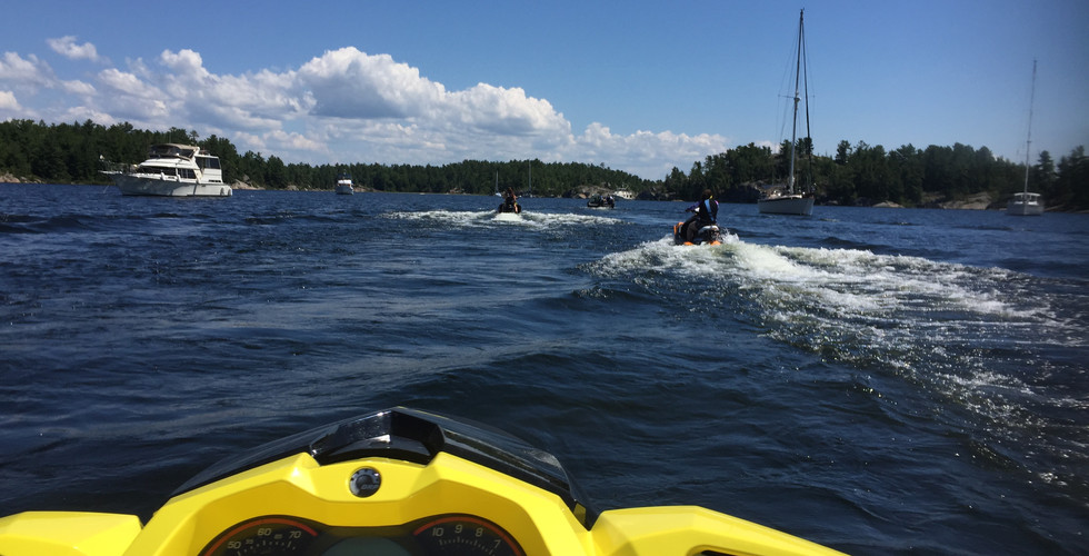
It was a calm summer morning in late August, the lake looked like a sheet of glass, as flat as the eye could see across the horizon. Early in the morning we launched the SEA DOOs at the Blind River municipal boat launch, then began our ride. Along the way you pass buy beautiful beachfront cottages and homes, some at water's edge, and some way up high on top of rocky cliffs. I could only imagine the view from up there. As we made our way, we followed the chain of islands and with our nimble SEA DOOs we were able to gracefully make our way between islands and channels. It was almost as if you were in a maze, always wondering when and where you're going to make it out and when you do, will you be lost? A few of the riders I've gone out with always feared when playing around in between the islands that it would be easy to get lost. The funny thing was that it's actually way easier than people think to find out where you are. I tell everyone the simple rule, if you're heading east then always make sure the mainland is to your left, and Manitoulin island is in the distance to your right. Simple enough right?
What am I Gonna See when I go There
Once you reach the WhalesBack, which again is the stretch of channel located between John Island, and the mainland (Serpent River Indian reserve), you will make your way through a chain of islands. This chain of islands is an explorer's paradise. Each island has a unique feature to it wether it may have a golden sandy beach, or a high cliff with a gorgeous views, or sheltered bays, and some islands are also covered in delicious wild blueberries. Let me tell you, I've been through the Whales Back multiple times, and never have I ever truly explored all the islands either on the water, or even the islands themselves on foot. However, all of the islands that I have explored are truly unique in there own way.
One of the most famous locations for people to visit along the Whalesback is a harbour called Beardrop Harbour. This harbour is used primarily as a sheltered harbour for sailors around the world who come up to visit. There are two ways of entering this harbour, one way through the west end (which is accessible by large watercraft) and the other way through the east end. The east end access is a narrow channel surrounded by gorgeous rock faces. Because this is such an intimate narrow and shallow channel, only small watercraft can fit through safely.


Comments